Leg 2 -> 10th Dec'2012 -> 1500 Kms
-> Ride in the State of Gujarat across the White Salt Desert
aka Greater Rann of Kutch.
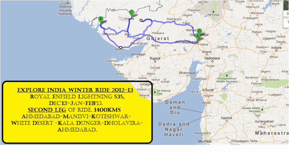
Major waypoints would be Mandvi Beach, Koteshwar (Narayan Sarovar/Lake), Chhari (Dand) Lake, White Rann Salt Desert, Kala Dunger, Dholavira (Excavation site of the Harappan Civilisation/ Indus Valley Civilisation & Salt Straights)... back to Ahmedabad.
Hope to enjoy wild camping in this Leg of Explore India Winter Ride, 2012-13.
Ride Updates during the period of this Leg shall continue on my Google+ profile :) since I won't be carrying the laptop into the Desert.
Hope to enjoy wild camping in this Leg of Explore India Winter Ride, 2012-13.
Ride Updates during the period of this Leg shall continue on my Google+ profile :) since I won't be carrying the laptop into the Desert.
RIDE UPDATE, LEG 2 :)
10th Dec'12.
I begin the Leg 2 at 0600 AM with a Gujarati-friend of mine who accompanies me for the initial 2days, thereafter he leaves back home due to urgent family-requirements.
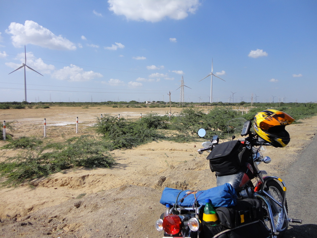
Harnessing wind-energy is Gujarat's strength, and these tall structures could be seen all along the Gulf of Kutch coast.
I begin the Leg 2 at 0600 AM with a Gujarati-friend of mine who accompanies me for the initial 2days, thereafter he leaves back home due to urgent family-requirements.
Harnessing wind-energy is Gujarat's strength, and these tall structures could be seen all along the Gulf of Kutch coast.
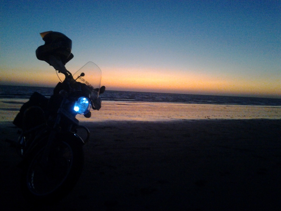
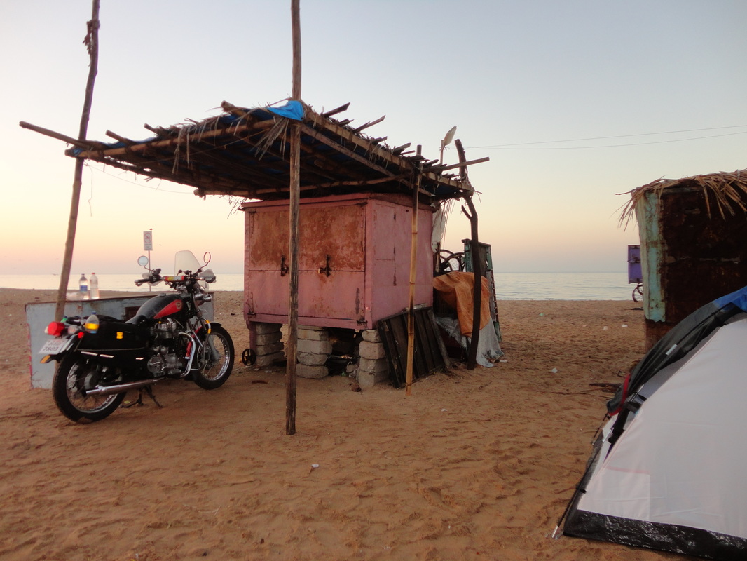
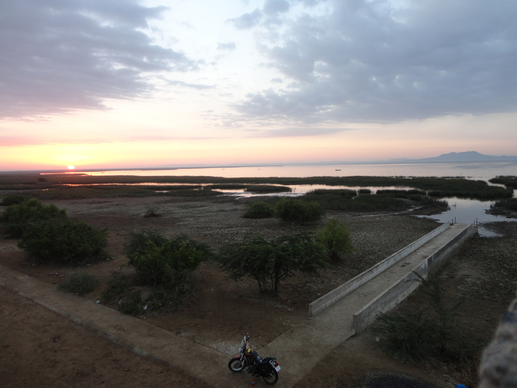
We reach the Mandvi Beach a few minutes after sunset.
After having a word with the local tea and coconut sellers(who were very helpful) at the Mandvi Beach , we decided to camp with my tent, keeping distance from the waves as it was going to be a tide-night.
The local hotel-guys would persuade you not to camp but book their filthy rooms at high prices instead.
These hotel-guys would say that you need the permission of local administration/police before you camp... but that is not at all the case. Go on with your tent and take care not to pitch it right on the beach, thats enough.
The next morning there is a 'pay and use toilet' right next to that bad-hotel at the beach, you can refresh yourself and even give your motorbike a bath with soft municipal water after a ride on the saline sea-water which promotes corrosion.
11th Dec'12.
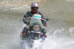
Good Morning Arabian Sea beach-ride :)
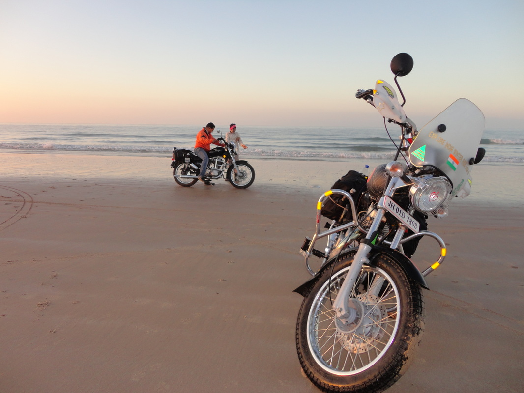
11th Dec'12.
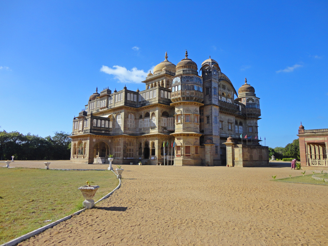
The first-half of this day is spent exploring the Royale life of the King at Vijay Vilas Palace at Mandvi...
11th Dec'12.
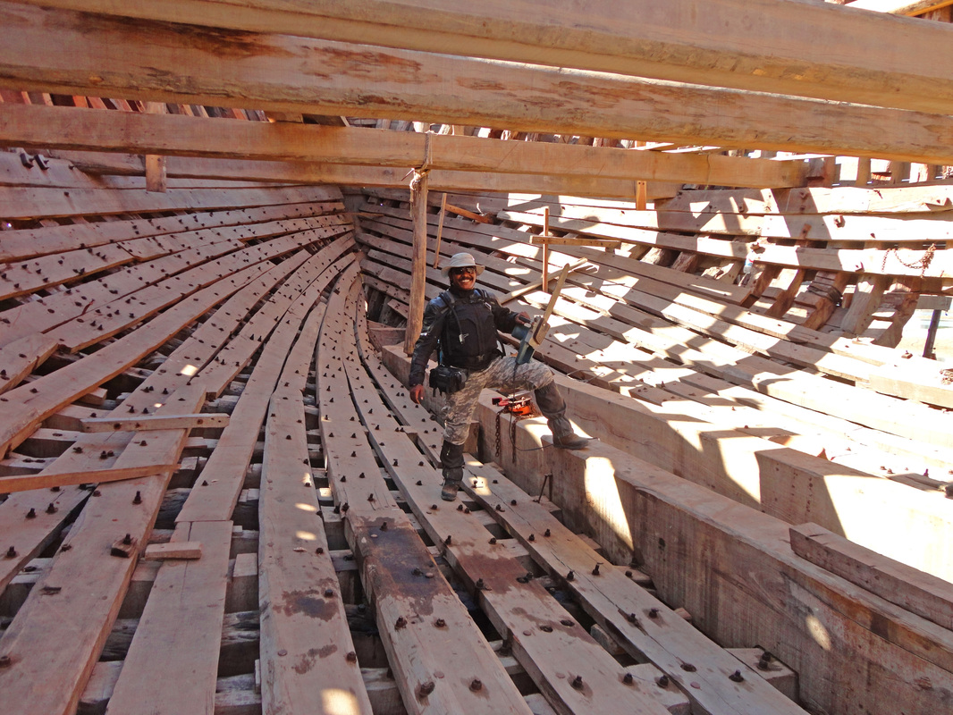
& Exploring the possibilities of ordering a custom made Ship (with wheels) at the ship building yard near Mandvi ;)
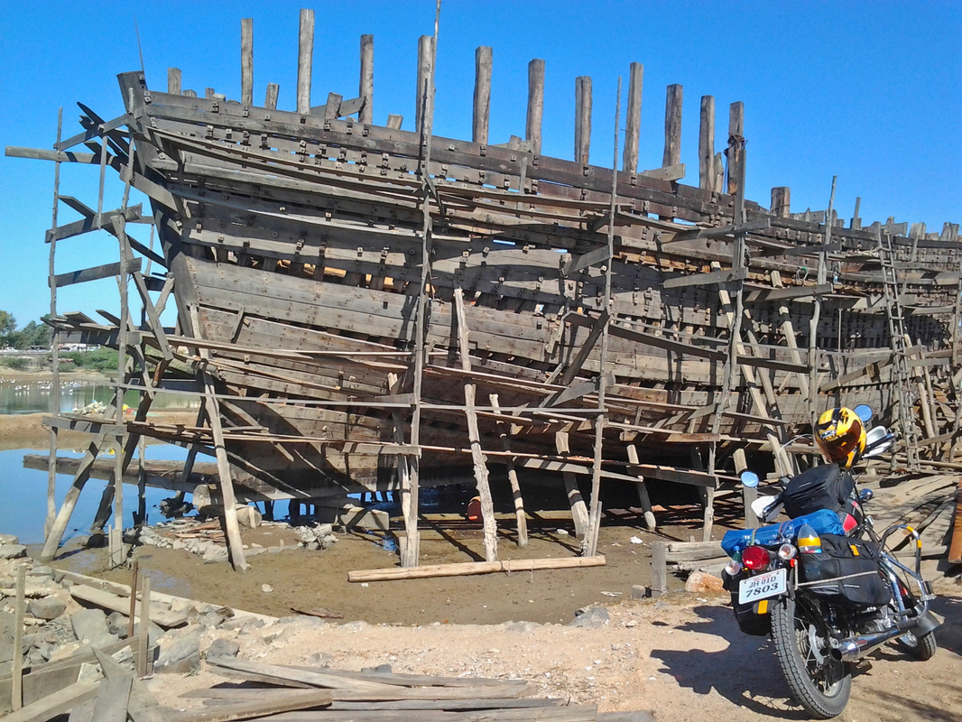
As a kid I was champion in making paper-ships, you want a big one of my craftmanship :)
12th Dec'12.
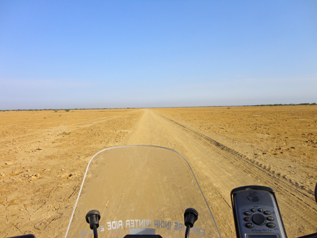
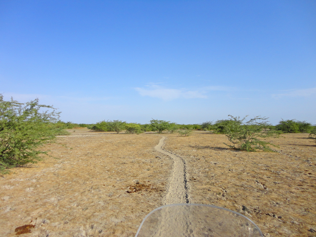
This is the day and location which marked my entry into the Greater Rann of Kutch filled with enduro paths yet to be explored and I'm all alone with my motorbike... The paved road soon gives way to treacherous unmapped enduro paths :)
12th Dec'12.
Its sad but true: Narayan Sarovar (Lake) in Koteshwar has dried out and the migratory birds are having a tough time.
Koteshwar had State Police an year ago which were unable to stop infiltration from across the Border... as a result the Border Security Force and the Indian Army are now on duty and vigil in this religious city which is the Western most point of India... camping is risky due to frequent checks going on by the BSF and Army separately late at night, one could end up showing his ID cards to the various patrol checks the whole night instead of sleeping.
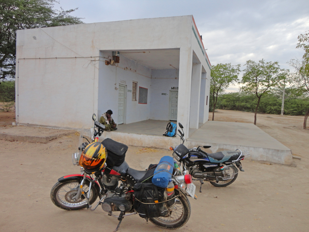
I prefered the 'Dharamsala' /religious place of stay with in-campus parking facility at Koteshwar... AC room for two at INR Rs.400/- or USD$7.5 per night with free lip-smacking vegetarian meals provided by the religious trust board at the Dharamsala.
12th Dec'12.
Some beautiful terrain on my way to Chhari Lake (this is one lake in Gujarat which never dries out :)
This is one of my favourite shots of this Leg.
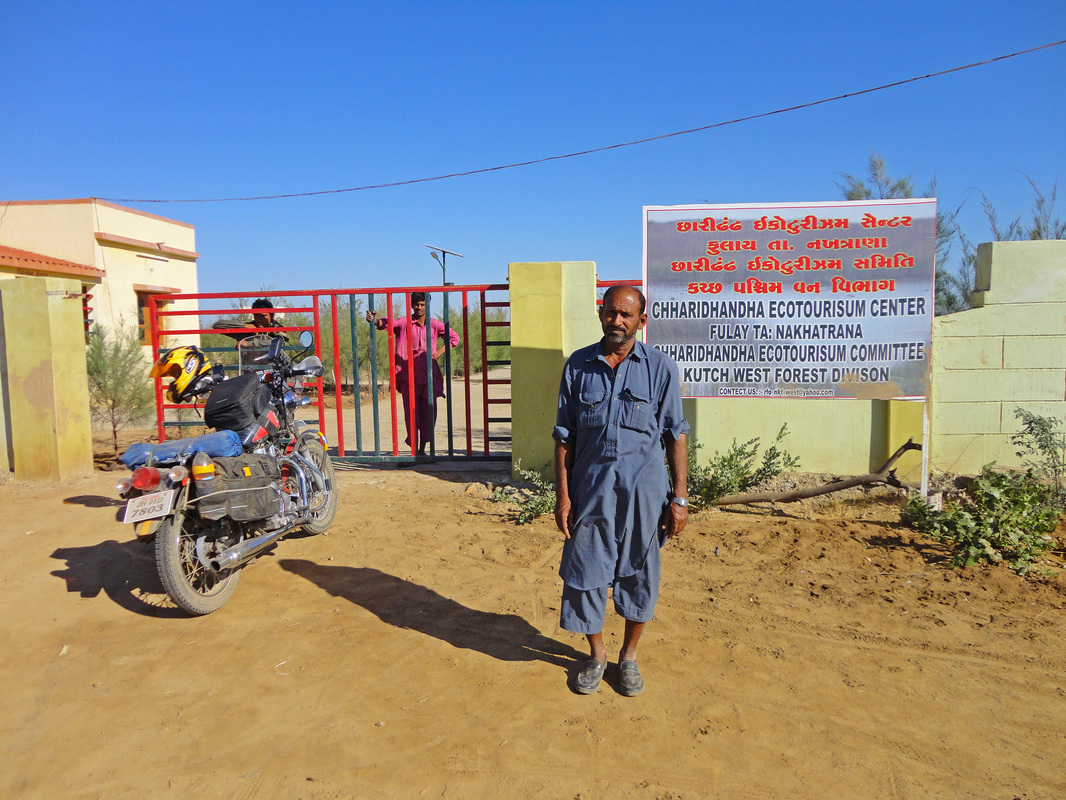
12th Dec'12.
The Official place of the Chhari Dand (Lake) with two guest rooms and its caretaker Mehmud Mutlas, he is one guy who can guide and take care of you in this desolate desert, he is a sincere and polite man. His office is the only place in the Chhari Lake region which has the RO (Reverse Osmosis) water filter. Since the Greater Rann of Kutch is mere 10mtrs above MSL, the soil and ground water is saline, and its nearly impossible to drink saline ground water without being treated. I'm sure you would like to be friendly with him ;)
The Lake has a concrete watch tower 2storeys high which is approximately 15kms/30minutes ride from this office.
12th Dec'12.
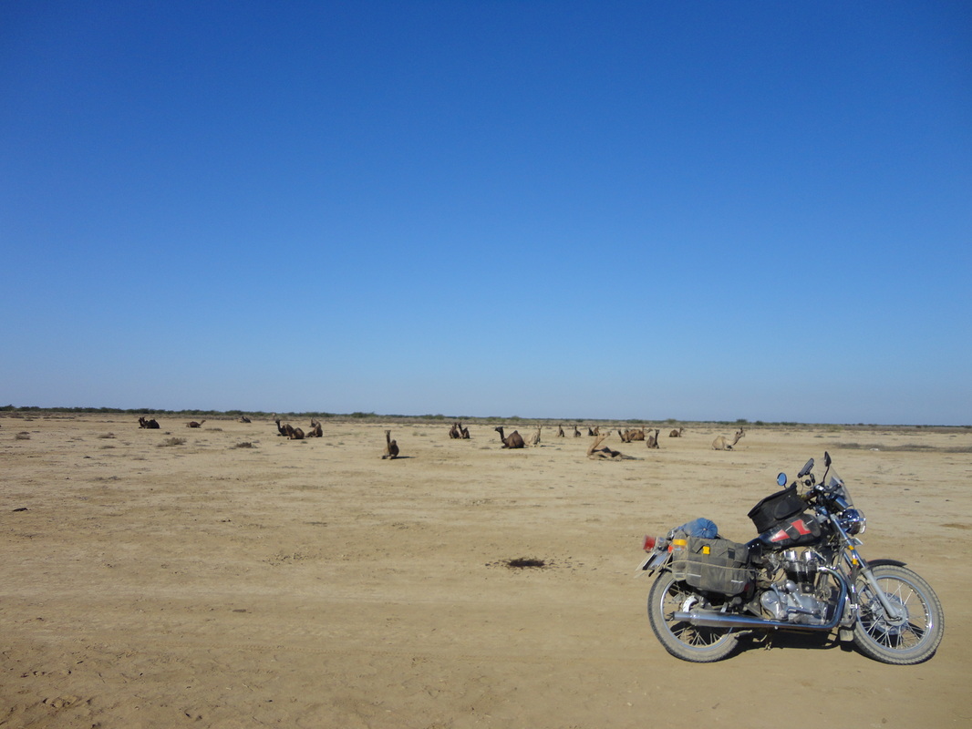
Although this is the Chhari Lake region but, it does not support big vegetation around itself, it is saline and only thorny shrubs (Babul; India Gum-Arabic Shrubs/trees) grow around it.
This shot is a mere 50mtrs from the lake: bone-dry and camels relaxing in the afternoon sun. It was damn hot in the riding-gear, Dec and 36°C !
12th Dec'12.
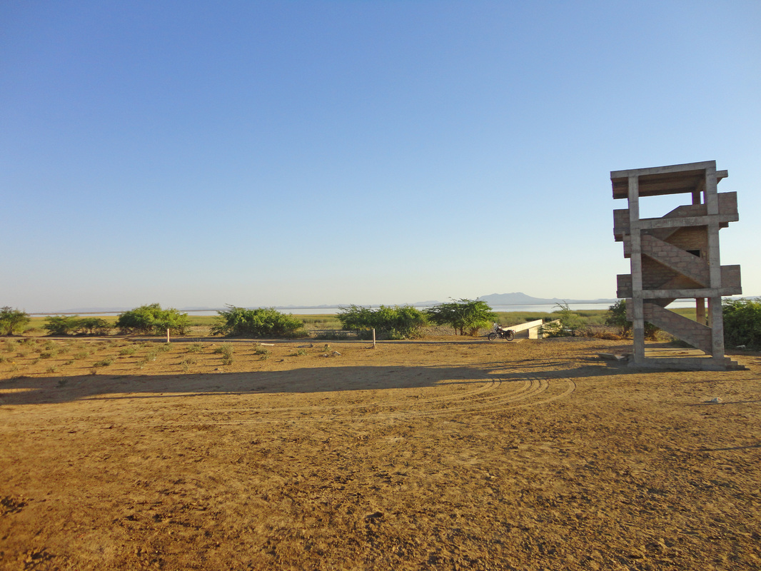
This is my camping location for the night (Chhari Dand), 15kms from the nearest human habitation.
Its a 2storeys high concrete watch tower overlooking the Chhari Lake. By the next morning I'm in trouble... it was hot and my stock of drinking water 3Ltrs is over, instead of moving ahead in the Desert towards Dhordo (White Rann Salt Desert) I'm forced to make a trip back to the Official place of Chhari Lake to refill my water bags. It becomes a 30kms round trip for 3Ltrs of drinking water :) Mehmud Mutlas is happy to help me out.
12th Dec'12.
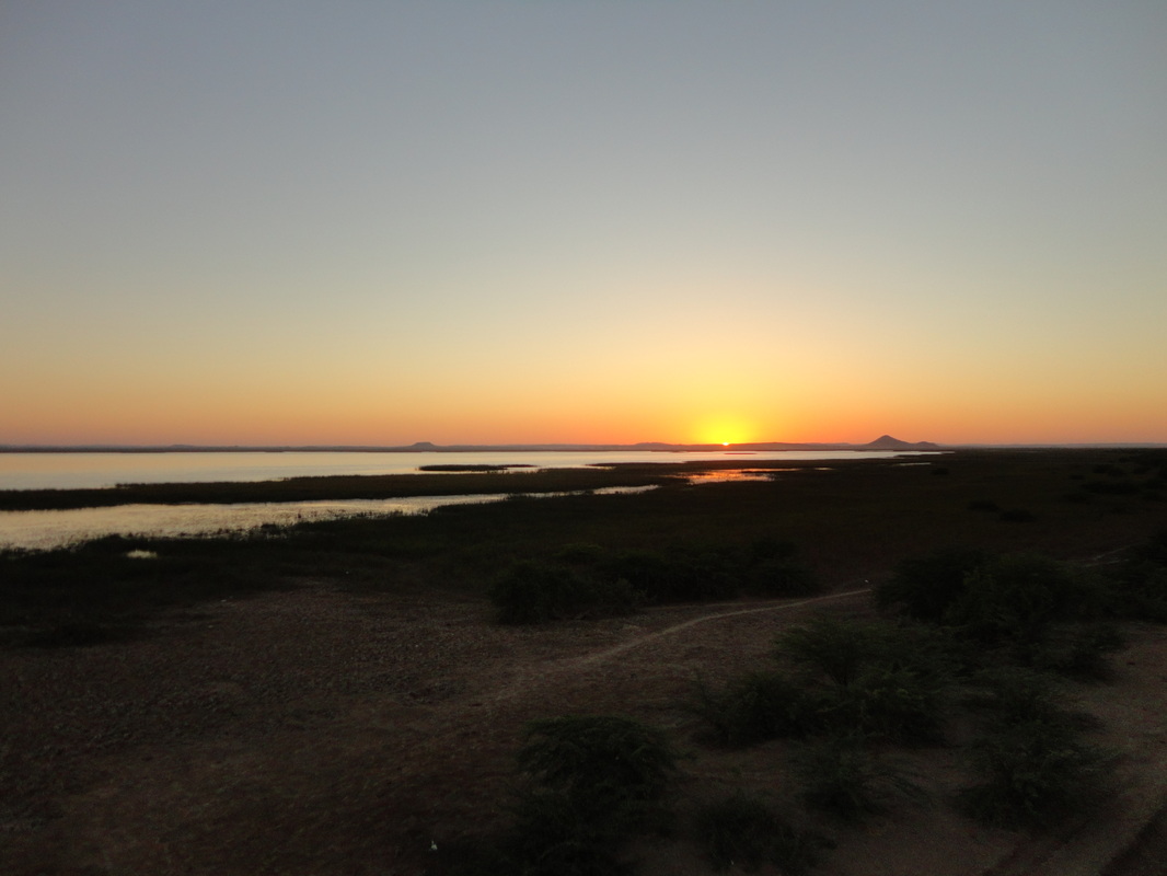
It is truly a rewarding experience deciding to spend the night at the Chhari Dand watch tower instead of the official guest rooms of the Chhari Lake. The calls of the various migratory birds numbering over 5Lakhs at sunset is unmatched.
Chhari Lake is 13Kms long and 6Kms wide :)
13th Dec'12
Instead of the usual alarm clock waking me up each day, this morning I woke up to the morning-call of over 200 species of migratory birds :)
13th Dec'12.
After fetching 3Litres of drinking water back from the Chhari Lake's Official place (detour of 30kms), I head north with a strong determination to succesfully traverse the Greater Rann of Kutch's Chhari North Forest Division filled with 50kms of India Gum-Arabic Shrubs/trees (Babul) with 2 inch long thorns.
This stretch does not exist on any map but in the knowledge of the locals and is truly the test of a man's endurance.
Even the locals dread to ride across this unspecified path... all I have is Garmin's directional compass and the will to ride across !
13th Dec'12.
This was the place I was about to lose my track... kept myself cool by stopping for a while taking videos + still shots, all in the sweltering heat of 36°C.
13th Dec'12.
Although it looks like a good jeep track but, this track came out of nowhere and vanished into the thick bushes ahead with no more trace of any wide path. I suppose this is a hidden track used by local drivers.
13th Dec'12.
I must now admit that pictures do not truly depict the fear of being lost or the challenges at surface level under the tread of your tyres. The picture below shows what I had to take track of in an unventured desert:
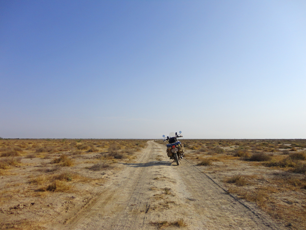
this track has been made by herds of wild and domestic animals (from villages nearby) moving around the desert and, I had to ride on these animal made tracks because the dried clay earth was very bumpy (together with loaded luggage) and the thorns lay scattered everywhere except this animal made path. The density and thickness of the thorny shrubs grew larger and wider as I rode ahead, at places I had to ride for kilometres on 1st and 2nd gear only at crawling speed because the thickness of the thorny shrubs would not easily allow me to pass them... and suddenly an unknown fear of failure began to grip me and it was then that I stopped taking halts or stopping for photography. I rode at crawling speed for 3 straight hours to cross the thorny bushes of this Desert and it was in this process that I missed taking pictures of this truly enduring challenge. But at that time, the fear of crossing this Desert was all that was in my head !
& I must praise the wind deflector and the hand-guards for keeping the thorny-pain away from me, the two are now full of scratches endured while deflecting the thorns away :)
13th Dec'12.
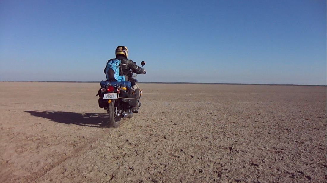
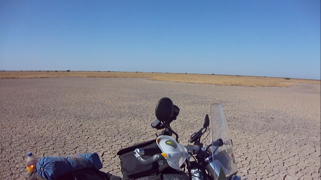
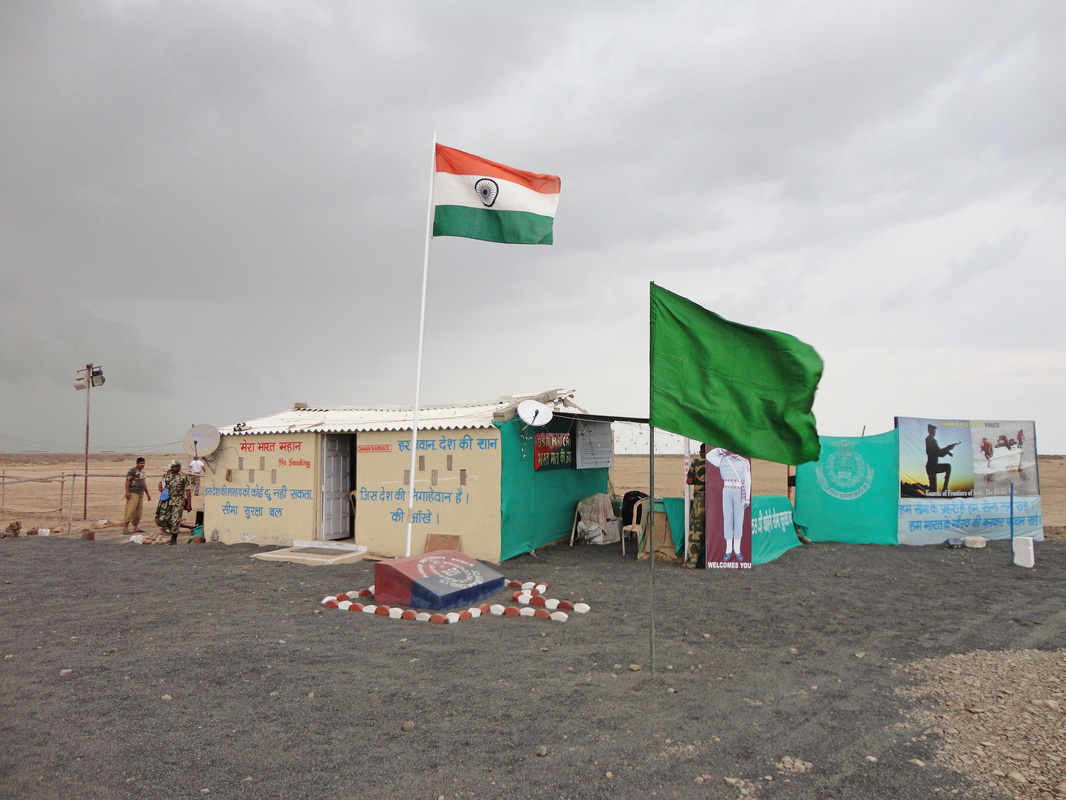
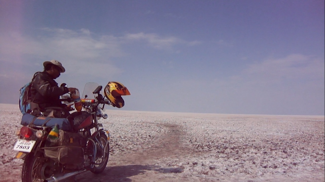
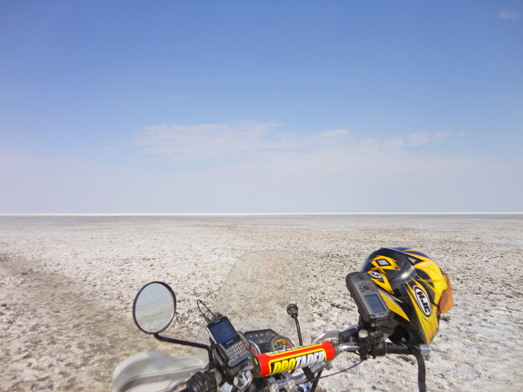
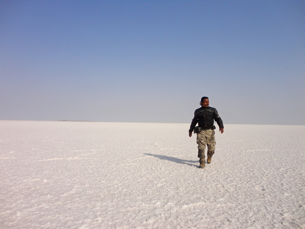
Ultimately I reach the Greater White Rann Salt Desert, which is 100kms of Salt Straights away from our neighbour.
As a precaution our Border Security Force is up to verify your credentials before letting you in the Greater White Rann. The soldiers are strict in their duties and humane in their approach to visiting tourists, they invited me for a late lunch which I heartfully obliged :)
On the left portion of the pic below is a violent sand storm + showers approaching us and within minutes most of the structures are uprooted (details in my forthcoming video).
13th Dec'12.
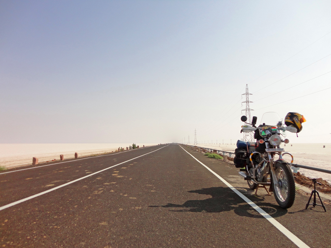
After completing the official formalities, its top-up time with the 4Litres of additional fuel that I carry in two cold drink bottles.
13th Dec'12.
The beauty that Salt Desert lay before one's eyes is truly majestic... and to be riding upon it is ultimate !
13th Dec'2012.
At the end of the day at Dhordo, time to pitch my tent among the thorny shrubs... it was just then that I met this man Md. Karimdar a friendly and very welcoming person. He asked me to spend my night at the community centre of his village and have dinner at his place. After dinner the youngsters of the village came to meet me and know of the adventure I gone through... their most anxious question was: how many punctures did my motorbike suffer ?
I would recommend every Adv Rider to ride into and interact with the locals, its a memorable experience :)
If any of you guys ever visit Dhordo (White Rann Salt Desert) and wish to meet Md. Karimdar, I can provide you his cellphone number.
14th Dec'12.
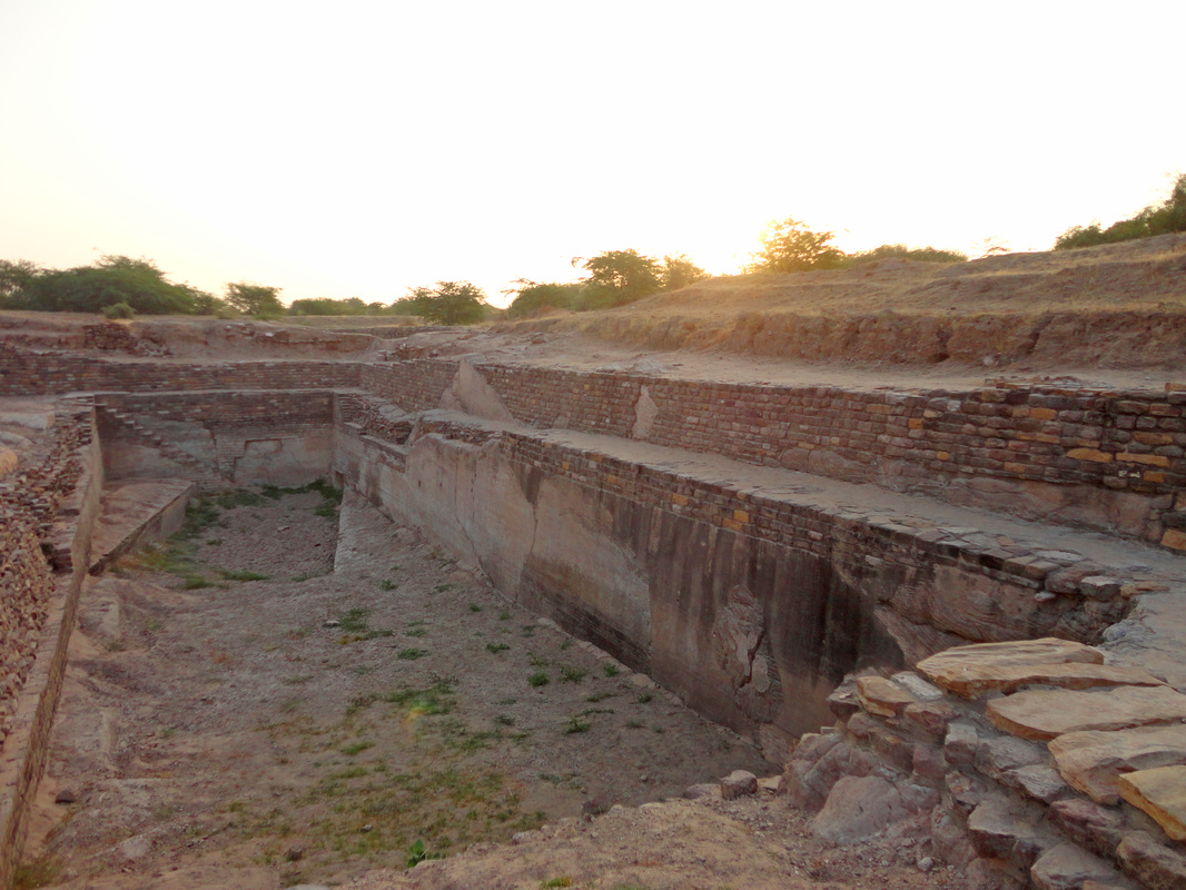
The final destination in my Leg 2 of Explore India Winter Ride, 2012-13 is the historical island city of Dholavira in the northern region of Greater Rann of Kutch in Gujarat.
The remarkable thing that makes Dholavira unique is the history behind this city dating back to 3000 B.C. to 1500 B.C., know the present world as the Harappan Civilisation/ Indus Valley Civilisation.
Dholavira is located in the 'Khadir Bet' island in the Kutch Desert Wildlife Sanctuary in the Greater Rann of Kutch. Dholavira is surrounded by the Salt Desert.
Excavation at this place began in 1989 till 2005 by the Archaeological Survey of India and it is estimated that only 10-15% of the site has been excavated, the remaining 90% of history and its mystery is still buried.
The excavation bought to light the urban planning and architecture, and unearthed large numbers of seals, beads, animal bones, gold, silver, terracotta ornaments, pottery and bronze vessels and even a 10,000 capacity stadium !
Fresh rain water conservation was an important aspect of city planning and the way drainage system was designed, it seems they had full knowledge of civil engineering :)
The pic below is of a water storage tank (16 such tanks are found) with overflow ducts to the next tank and a ramp for the bullock-carts to fetch out water. The fresh river water of monsoon coming into the tank had an elaborate filtration system: firstly pebbles, then smaller chip stones, then sand :)
14th Dec'12.
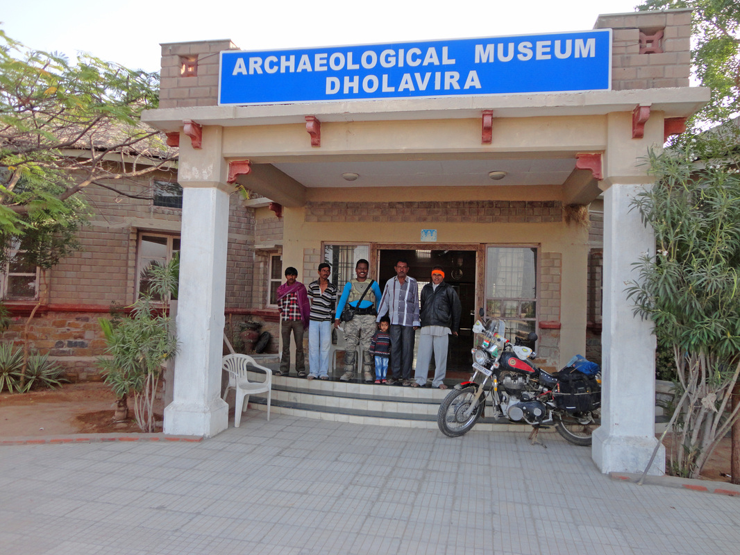
The Archaeological Museum & the excavation site at Dholavira is a treasure yet to be discovered. The lone Official caretaker of the museum Mohammed (2nd from right) is a very helpful and warm hearted man. He would not let me pitch my tent but provided me a vacant official residence within the museum premises and invited me for dinner at his home :)
Mr. Ravji Bhai (1st from right) is a local guide of Dholavira who has seen all the developments relating to the excavation works and has prime knowledge of the history discovered, his official fees is Rs.200 or USD$4. Ravji Bhai can be called upon by asking the musuem's caretaker Mohammed.
14th Dec'12.
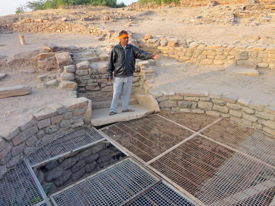
The guide Mr. Ravji Bhai; he stands at the place where water-fetchers would stand in 3000 B.C., and pull out with the help of bulls, leather-buckets filled with fresh water. The stone-slab on which Ravji is standing bear marks of the rope rubbed against it when the leather-buckets were pulled out. The well was 80+ feet deep those days... today 40 feet of it is filled with earth. The wire-mesh lid had been put a few years back by the Archaeological Survey of India.
15th Dec'12, Last day of Leg 2 of my Explore India Winter Ride, 2012-13.
It had been a glorious ride for me across the State of Gujarat.
I will now traverse my way out of the Greater Rann of Kutch's Salt Desert surrounding the island city of Dholavira.
15th Dec'12.
Good bye friends, meet you again when I complete my next Leg 3-9 of Explore India Winter Ride, 2012-13 to the Southern part of India along the Arabian Sea coast.
Ride of Leg 2 completed on 16th Dec'12 at 0730 Hrs IST.
It is now after completing the Leg 2 of this Ride do I understand what Extreme Solo-Enduro Riding means :)
Secondly the route-itinerary for the Leg 2 was like party hard (at Mandvi Beach) before the toil begins... which could have been planned as to party after completing the enduro-challenge. I mean the enduro locations were planned after the beach party (1st stop) in this Leg, which could have been planned otherwise.
It were the enduro sections around Chhari (Lake) Dand to Dhordo: 100kms of Kutch Desert full of India Gum-Arabic Shrubs/trees (Babul) with 2 inch long thorns, which I loved the most... & yes it was the most extreme and fearful terrain I ever rode on in my riding history.
Lastly I would like to add words of praise from the bottom of my heart for the indigenous Muslim people of the whole of Greater Rann of Kutch region. They are a very generous and helping natured community. The structure of their faces may make them seem cruel or rude but, once you begin a conversation, you would most certainly get the warm hearted response. On four occasions during this Leg I was in need of some help and I got total support which they could provide me from their stand point. They would not allow me to pitch my tent in their surrounding but give me comfortable places to sleep the night peacefully, they would not allow me to eat my pre-cooked ready to eat food but, invite me for meals from their homes.
What more could a traveller expect from the local communities he/she is travelling through !
CAUTION: Before entering the Chhari Dand to Dhordo enduro-section, make sure you have:
plenty of time at hand; keep one day for the Chhari lake to Dhordo enduro path,
have the required expertise, tools and spares to troubleshoot break-down problems of your motorbike,
fuel tank topped up,
the capability & resources to mend punctures or replace tubes; I was carrying 2 spare tubes.
minimum 3 litres of drinking water; its good if you have the Stoaway 2/3L,
first-aid kit (against thorn pricks & probable scorpion stings),
a GPS sat nav; practise beforehand the compass aided navigation, because this path is not there on any GPS sat-nav,
lastly, never enter if there are possibilities on showers/rain enroute the enduro path, because the Greater Rann of Kutch has clay-soil which behaves like gum if wet, even tractors get stuck.
Late December to March is the best time to go enduro in the Greater Rann of Kutch region.
TIP: The city of Bhuj lies in the centre of the Greater Rann of Kutch, and it is the only city in the Greater Rann of Kutch region having fuel pumps. So before you venture out in the enduro terrain desert make sure of the number of kilometers you would be travelling and the economy of your vehicle in terms of off-road efficiency.
My RE Lightning 535 is rally-tuned, riding on off-road terrain my Royal Enfield gave me the best efficiency of 18Km/litre, on paved tarmac it was 26Km/litre @ 70Km/Hr... my calculations required me to carry two cold-drink bottles with 4Litres of additional fuel in them, to be on the safe side :)
